A Sustainable Approach to Reservoir Management:

From the early pioneers on the Snowy Mountains Hydroelectric Scheme, to our leaders and innovators of today, our people make us who we are.
Through our network of global specialists and by collaborating with local partners, we connect you with the best teams and capabilities to deliver highly innovative and sustainable solutions.
As an organisation we are continually evaluating ways we can better provide a safe, flexible, inclusive and respectful workplace for our people and clients.
People are at the heart of our organisation, we strive to create a flexible, diverse and inclusive environment that enables our people to thrive to their fullest potential.
Explore career opportunities
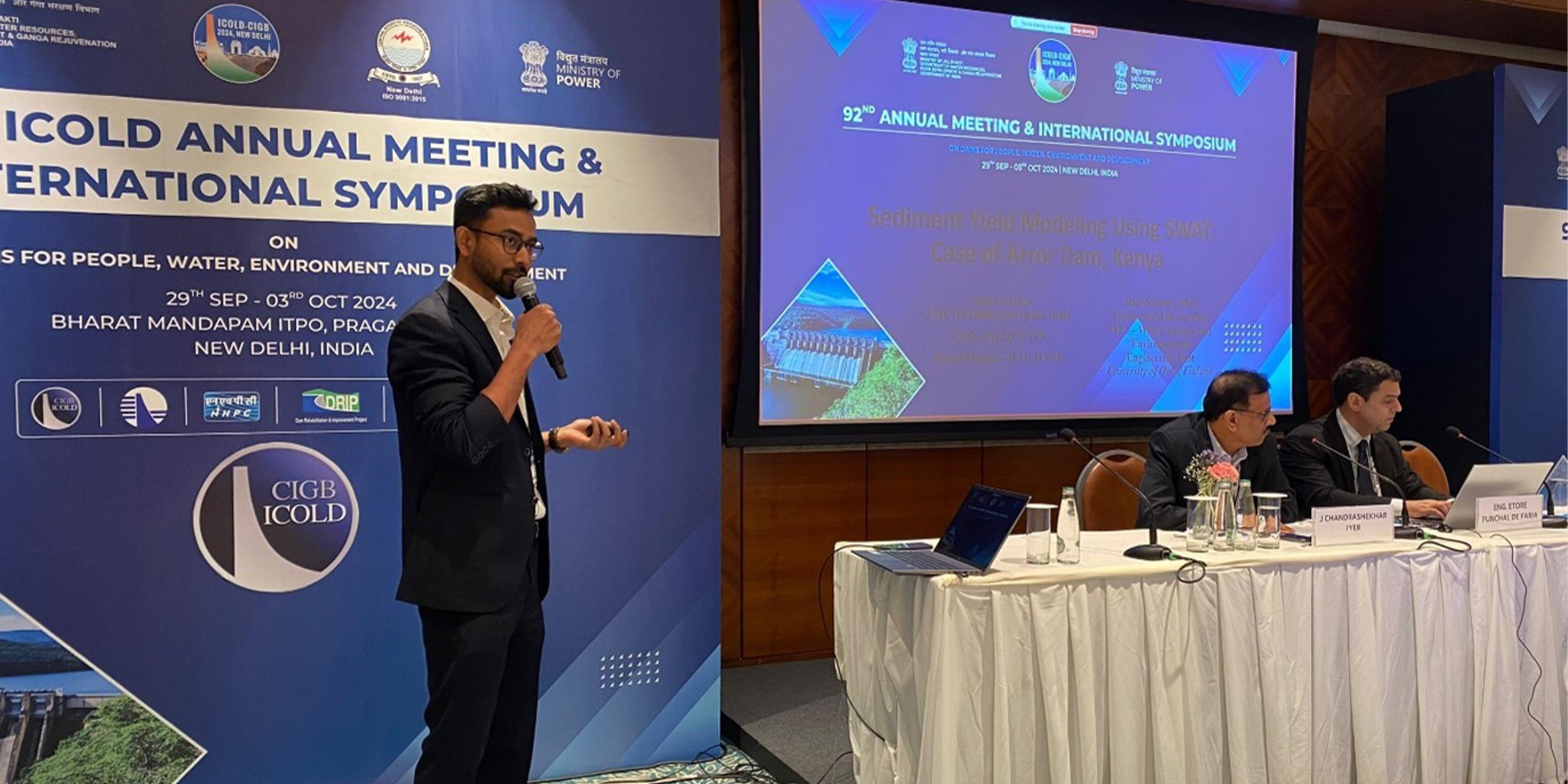
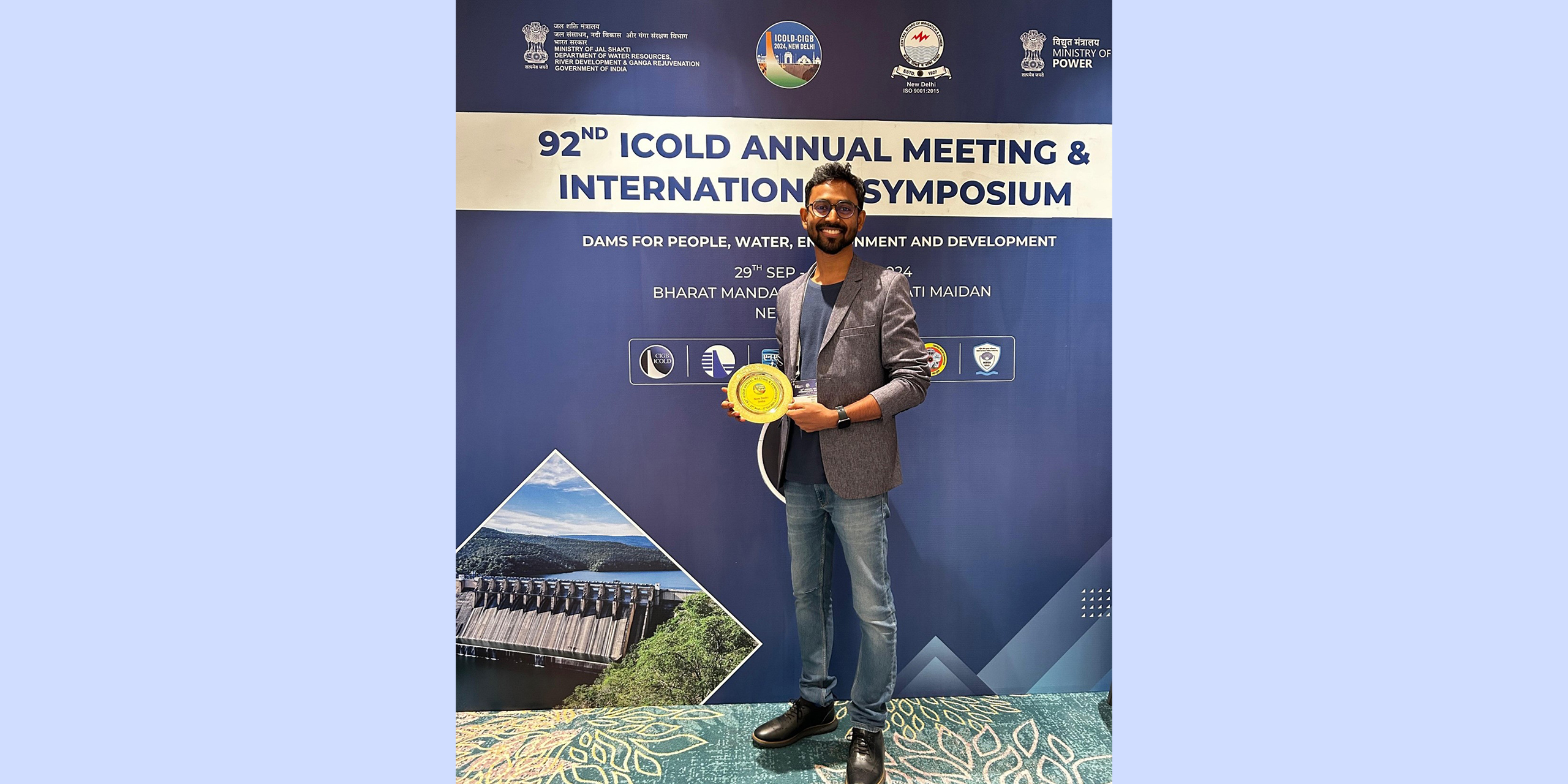
In a paper presented at the Young Professionals Forum during the ICOLD 2024 92nd Annual Meeting and International Symposium, we showcased groundbreaking work in sediment yield modeling using the Soil and Water Assessment Tool (SWAT). The research, a brief overview of which is provided in this article, applies SWAT to model spatial and temporal sediment dynamics, introducing an innovative calibration and validation method using satellite-derived evapotranspiration data. This approach offers a new pathway for hydrological modeling in regions with limited ground data and provides critical insights for managing sedimentation in dams and reservoirs under future climate scenarios.
The primary aim of the research presented was to address the issue of reservoir sedimentation in dams and reservoirs. The work presented specifically focused on analysing spatial patterns of soil erosion and temporal changes in sediment yield for a representative dam, utilising the SWAT model within the ArcGIS platform. An innovative approach was explored for calibrating and validating the model based on satellite-derived actual evapotranspiration (AET) data. This method offers a new way to calibrate and validate hydrological models in data-scarce catchments.
The research involved an assessment of water-sediment interactions, predictions of future sediment loads and the prioritisation of critical soil erosion areas, all conducted using SWAT. This widely used, open-source semi-distributed eco-hydrological model integrates information about weather, land use, soil types and topography to simulate hydrological processes and forecast the impacts of discharge, sediment transport, bacteria, nutrients, biomass and pesticides over extended periods. SWAT divides the watershed into sub-basins and further into hydrological response units (HRUs), based on land use, slope and soil type data. SWAT can simulate water and solute dynamics at various temporal scales — daily, monthly and yearly — across the studied river basin, with simulations primarily conducted monthly.
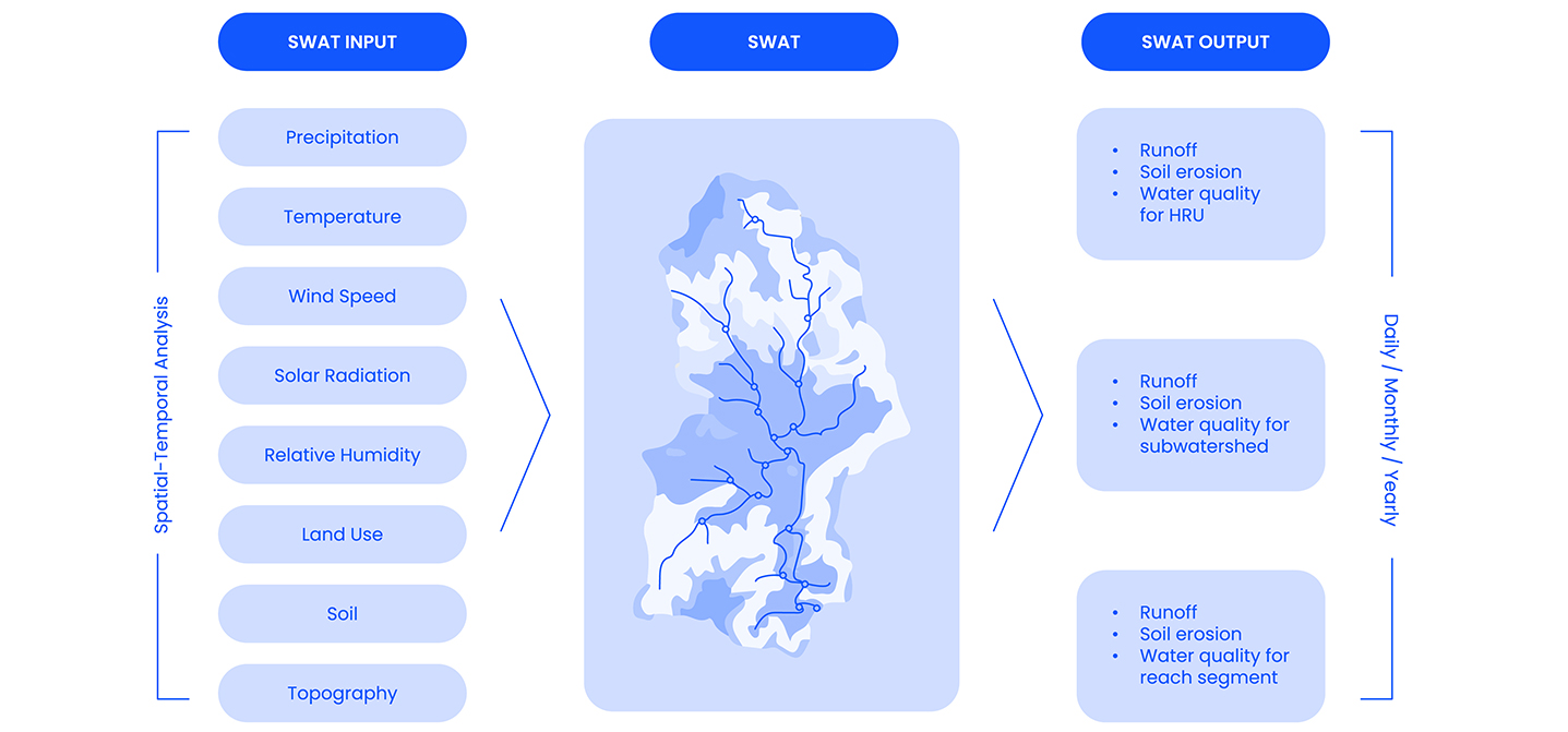
To consider the variability in precipitation and temperature due to orographic effects, the elevation band module was used. For potential evapotranspiration calculation, the Hargreaves method was selected, as it utilises only the input of daily air temperature. Once determined, SWAT estimates the AET. The soil erosion assessment was done in SWAT using the modified soil loss equation (MUSLE), which quantifies runoff to estimate sediment yield. For comparison of SWAT-simulated AET with AET data available from GLEAM_v3.0a, for each sub-basin, the NetCDF raster layer of GLEAM was used. This allowed visualisation of how many pixels lay over the catchment, and values were extracted by converting the raster to points and viewing the NetCDF table in the ArcGIS interface. The SWAT-CUP model was adopted for automatic calibration, validation and model uncertainty/sensitivity analysis using the Sequential Uncertainty Fitting algorithm version 2 (SUFI-2). A set of 21 parameters was chosen based on local conditions and available literature from the region. These parameters could be modified either by absolute increase/replacement or relative change to the default parameter values within the defined calibration range. Using the SWAT-CUP model, four iterations of calibration were conducted, with 500 simulations performed in each iteration. After each run of an iteration, the model narrowed down the parameter set for the next iteration, within physical limitations.
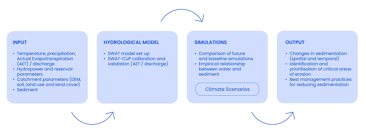
Future scenarios were investigated for two Representative Concentration Pathways (RCPs 4.5 and 8.5) using three different open-source global climate models. Both current conditions and future climate scenarios were assessed, with sediment production modeled and solutions proposed for long-term scenarios through 2100. The SWAT model provided reliable quantitative forecasts of reservoir sedimentation, along with qualitative spatial and temporal distribution at the basin scale. Simulations suggested that sediment load and discharge would decrease under future climate scenarios, primarily due to temperature increases. The findings of this study document significant indicators of high-risk soil erosion hotspot areas within the catchment.
The impacts of climate change on discharge and sediments are complex and warrant further research to overcome several limitations. SWAT-based hydrological responses are highly sensitive to the quality and quantity of input data, particularly precipitation and temperature projections. Future studies should focus on improving SWAT’s sediment yield modules to better assess these factors under various climate scenarios.
The research offers a starting point for project owners to manage and prioritise adaptation and remediation policies related to reservoir sedimentation. Reservoirs often suffer from sediment accumulation, reducing capacity and threatening water quality due to micropollutant contamination. With climate change expected to exacerbate these issues, effective management strategies are increasingly vital.
This study demonstrates the potential of using open-source databases for hydrological modeling in data-scarce basins, producing reliable results despite limited in-situ data. The novelty lies in leveraging remote sensing data (e.g., AET) to calibrate hydrological models where traditional data sources are unavailable. The results will be highly valuable for new and under-construction hydropower projects, especially in developing countries with limited data availability. In the long term, the adaptive models and insights generated can support more effective reservoir sedimentation management in the context of changing climate conditions.
Bridge infrastructure is at a pivotal moment. Across developed and emerging economies, governments and asset owners are responding to a complex mix of challenges: ageing assets, growing freight and passenger demand, constrained investment, climate pressures, and rising expectations around sustainability and resilience.
Rapid growth in data driven services is reshaping how power infrastructure is designed for digital assets. Data centres are no longer peripheral electricity users supported by strong national grids and local backup systems.