Expertise

From the early pioneers on the Snowy Mountains Hydroelectric Scheme, to our leaders and innovators of today, our people make us who we are.
Through our network of global specialists and by collaborating with local partners, we connect you with the best teams and capabilities to deliver highly innovative and sustainable solutions.
As an organisation we are continually evaluating ways we can better provide a safe, flexible, inclusive and respectful workplace for our people and clients.
People are at the heart of our organisation, we strive to create a flexible, diverse and inclusive environment that enables our people to thrive to their fullest potential.
Explore career opportunities
SMEC overlays its design model on top of this scalable mesh, bringing in designs from a multitude of CAD applications into a common data environment. This provides rich levels of functionality that include simulation, clash detection, costings, quantities, collaborative design workflow integration across multi-disciplinary teams, as well as design review updates.
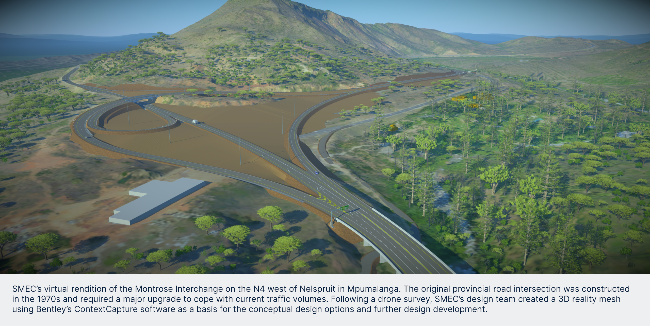
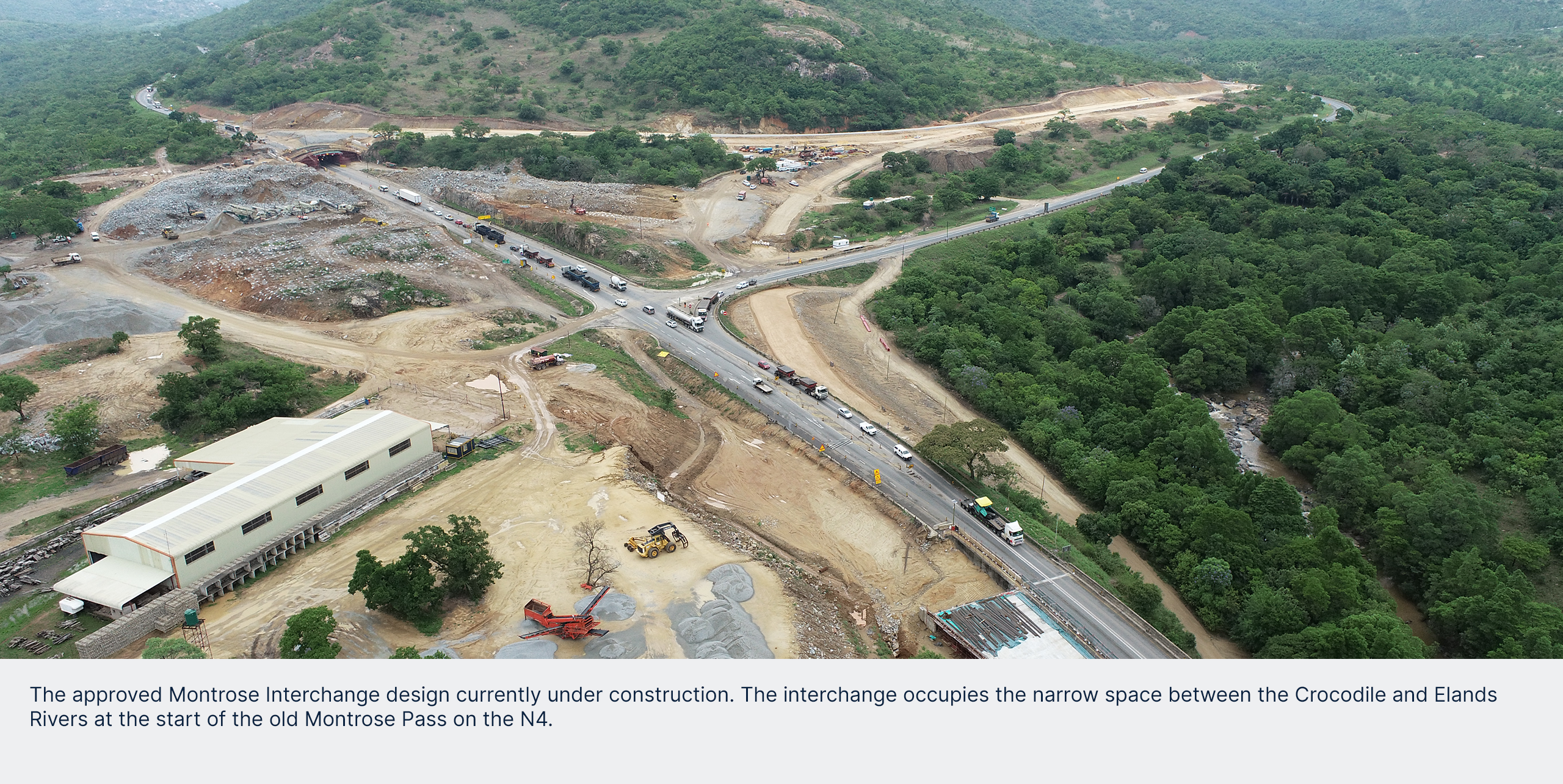
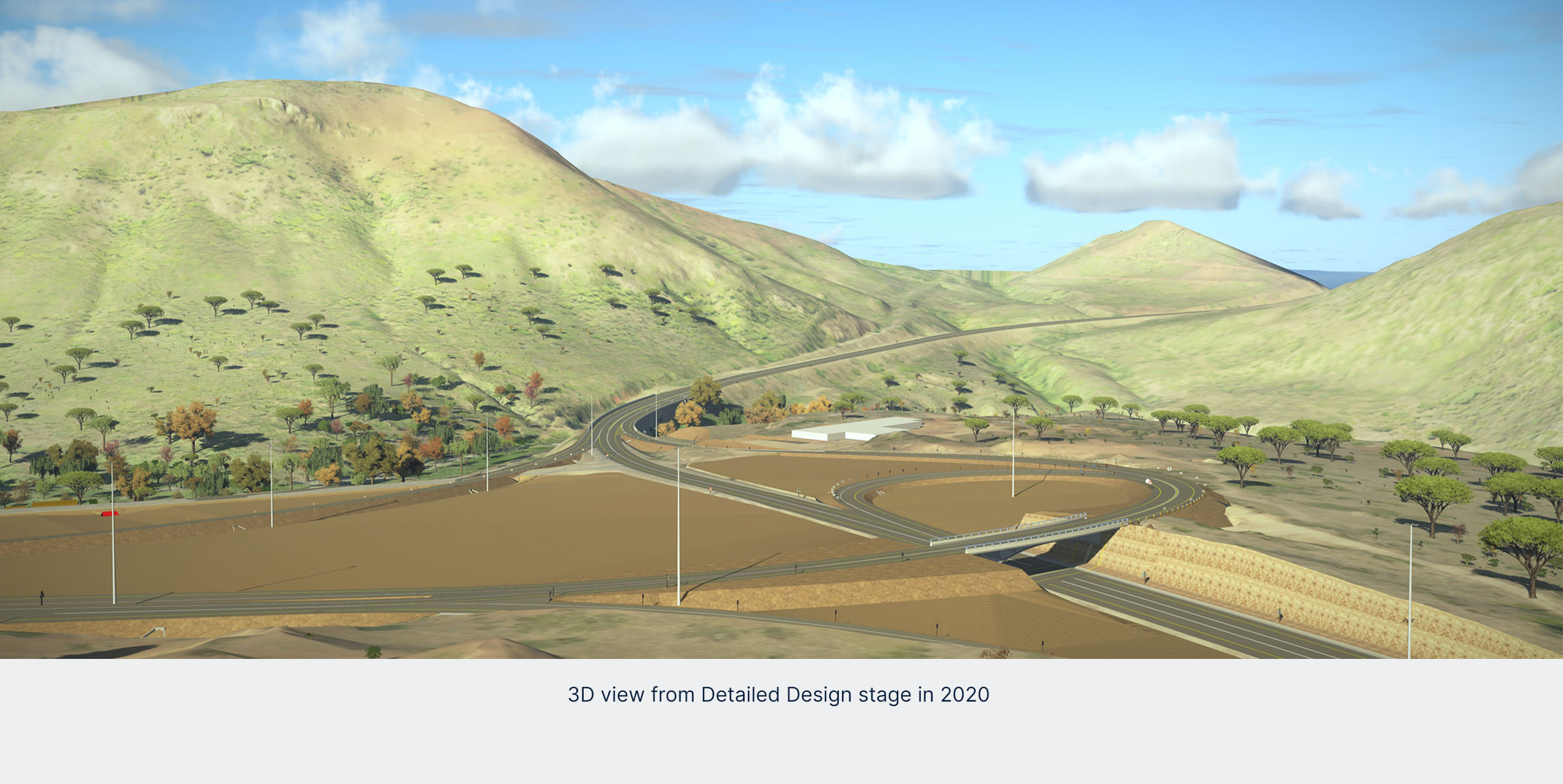
Starting with the baseline design, and thanks to advances in 3D modelling software, Archer says it’s extremely valuable to develop 3D conceptual design models that can be used as a basis for client and community stakeholder discussion during the feasibility phase, and then to interrogate and refine it further during the design development stages to ultimately take the project through to fully digital-driven construction.
A practical example is a future planning study carried out for TRAC at Schoemanskloof. Here the existing road has a speed limitation of 100 km/h due to the challenging terrain and the existing horizontal and vertical curvature of the road. To showcase one option to improve the level of service (LOS), travel time, and safety, SMEC submitted a conceptual design overlaid on a scalable mesh design showing a proposed new alignment in an oblique view. TRAC’s engineers were then able to visualize SMEC’s proposal and evaluate the proposed alignment on site.
“There’s no doubt that 3D models convey the message with far more clarity than a conventional cross section or layout drawing, something that clients really appreciate,” Archer explains.
To enhance the digital experience, SMEC has a Management Services Function that develops purpose designed maps and apps for use by its personnel as well as its clients.
“In TRAC’s case, the engineers are using the app to carry out route inspections, future planning scenarios, or to validate design proposals using a tablet to log reports by taking a photo and/or adding a voice or written note. Since all available terrain information is preloaded, location photos taken are instantly recognised and referenced,” Archer continues.
In terms of its agreement with SANRAL and ANE, there are set LOS targets that TRAC must adhere to now and in the future during the concession period, which requires submitting a status report annually. The LOS scale runs from A through F and forms the basis of current operations management and future planning.
An A rating indicates idyllic driving conditions, while an E rating indicates heavy congestion and a situation where road users travel under very poor and frustrating conditions. An F rating, in turn, indicates a complete failure of the facility.
Globally, the Highway Capacity Manual (HCM) issued by America’s Transportation Research Board is one of the benchmarks for measuring traffic flows and calculating LOS.
To advance what has traditionally been a manually intensive process of reprocessing HCM calculations for different scenarios, SMEC has created a traffic-centered 560 km digital twin of the entire Maputo Development Corridor as a microsimulation model using the PTV Vissim multi-modal traffic flow simulation software. As the term microscopic implies, this is a highly detailed simulation model.
SMEC has calibrated the model in terms of metrics like driver behaviour, actual travelling speeds measured on the road, and vehicle class performance for every section of the N4 that TRAC is responsible for. This model includes all significant interchanges and intersections on the route. The results of these microsimulations can then be used to advise on infrastructure upgrade requirements to maintain the level of service experienced by road users.
When TRAC submits its LOS report each year, all the latest traffic data recorded at various counting stations, as well as the N4 toll plazas, are analysed and reported on.
Another solution developed for the TRAC concession is a holistic assessment plan. “Using our data, we’ve been able to consolidate existing road infrastructure, geometric alignment, heavy vehicle travel speeds and accident statistics over the past five years and plot them along the route to pinpoint hotspots. We overlay this with the PTV Vissim model analysis to identify where additional lanes and/or passing lanes are required on specific sections to maximise LOS and improve safety,” Archer continues.
To further refine its delivery models, SMEC is exploring the world of artificial intelligence (AI). “As an AI project experiment, we captured a section of road, with a specific focus on road signs, and ran it through an AI model. Each road sign was automatically geo-referenced and positioned in CAD, identified in terms of type and material, dimensioned, and quantified. This exercise definitely shows the potential for AI to process data and use to promote accuracy and efficiency,” adds Archer.
“Going forward, our objective is to leverage digital technologies to achieve more efficient results and workflows. In this respect, we’ve come a long way in the past five years, constantly shifting the boundaries of virtual design to engineer safer and more effective transportation solutions,” Archer concludes.
This article was also published in the April edition of IMIESA magazine
I often ponder about the future of our industry and where technology will lead us and indeed, where will we lead technology. Is technology challenging the equilibrium when it comes to a full-service offering in the engineering industry? Some would say yes if our lives today are anything to go by.
Australia is in the midst of a significant energy transformation. It’s estimated that by 2040 the vast majority of Australia’s coal-fired power stations will have been retired, and the nation should be running on 85% renewable energy.
This week is National Water Week in Australia, an opportune time to take stock and consider the existing trends and emerging smart technologies within the water, dams and hydropower space.
It is an exciting time to live in Southeast Queensland (SEQ), Australia. It’s even better if you work in planning and engineering. This is because a complex, multi-faceted City Deal proposition called TransformingSEQ was recently launched, followed by in-principle agreement at the local, state and federal levels of government to progress the SEQ City Deal proposal. City Deals are a key mechanism of the Government’s Smart Cities Plan (2016) and provide a new approach for all levels of government to work together to strategise and deliver transformative outcomes for Australian cities.