Port of Townsville Channel Upgrade

From the early pioneers on the Snowy Mountains Hydroelectric Scheme, to our leaders and innovators of today, our people make us who we are.
Through our network of global specialists and by collaborating with local partners, we connect you with the best teams and capabilities to deliver highly innovative and sustainable solutions.
As an organisation we are continually evaluating ways we can better provide a safe, flexible, inclusive and respectful workplace for our people and clients.
People are at the heart of our organisation, we strive to create a flexible, diverse and inclusive environment that enables our people to thrive to their fullest potential.
Explore career opportunities
SMEC was engaged to undertake the detailed design of the rock bund wall, a structure that has been used to safely accommodate the dredged material from the channel widening. The Port has re-used the dredged material produced by the Channel Upgrade project works to form a land reclamation area, which will eventually form part of the outer harbour, in line with the Port’s long-term development plan.
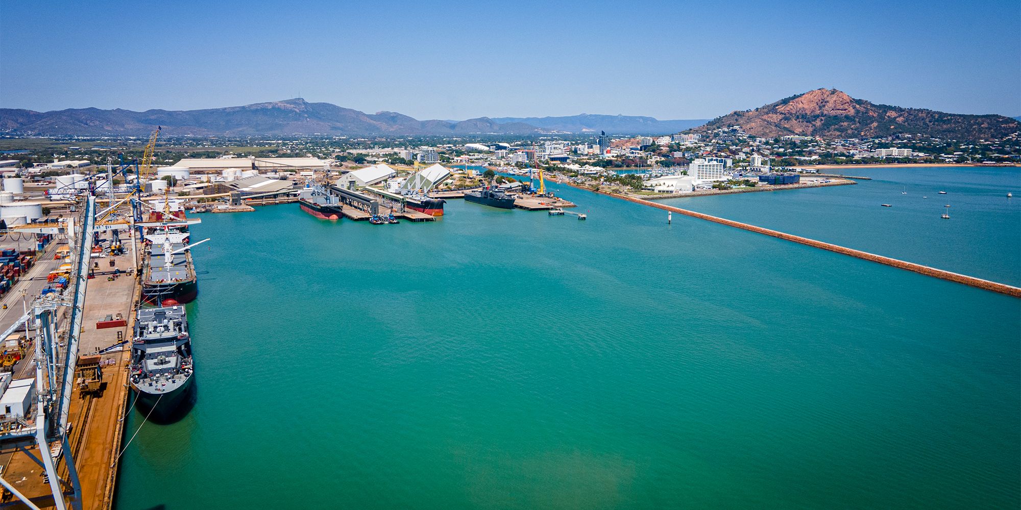
Dredging has recently been completed, with all dredged material successfully placed within the rock bund wall reclamation area. The Channel Upgrade project will be complete by the end of 2024, allowing cruise, commercial and defense vessels up to 300m in length to safely navigate to the Port of Townsville. This will be a significant contribution to the future growth and economic potential of the region.
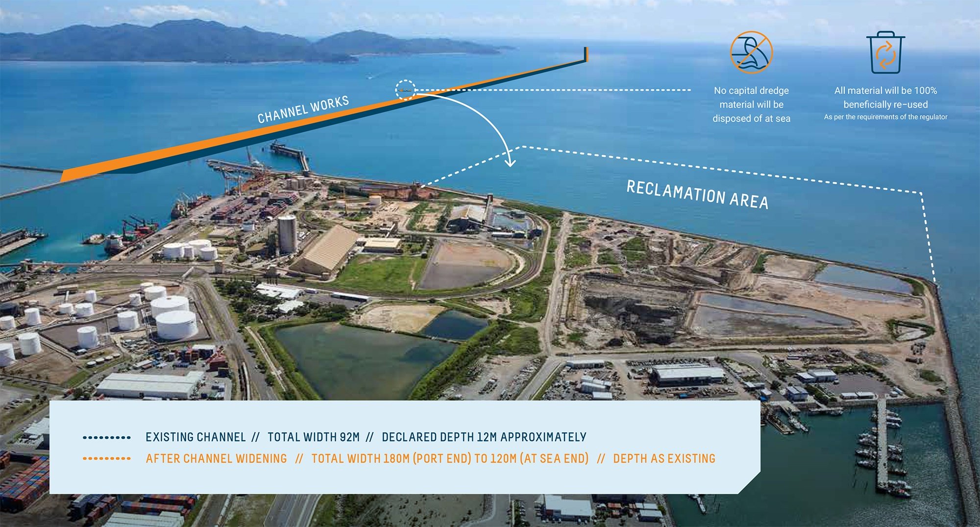
Figure 1 – Channel Upgrade Project Summary
The rock wall bund is currently constructed to an intermediate stage which enabled the dredge material to be placed within the reclamation area. Now that the dredge material has been placed, the remainder of the rock bund wall can be constructed, which comprises rock protection at the rear of the structure. The rock protection works consist of additional layers of large rock, providing additional stability against the impact of high tides and waves generated during cyclones. A summary of key design highlights is provided in the physical model photographs below.
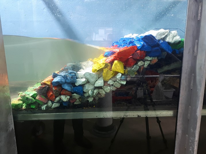
Figure 2 – Intermediate Bund Physical Model
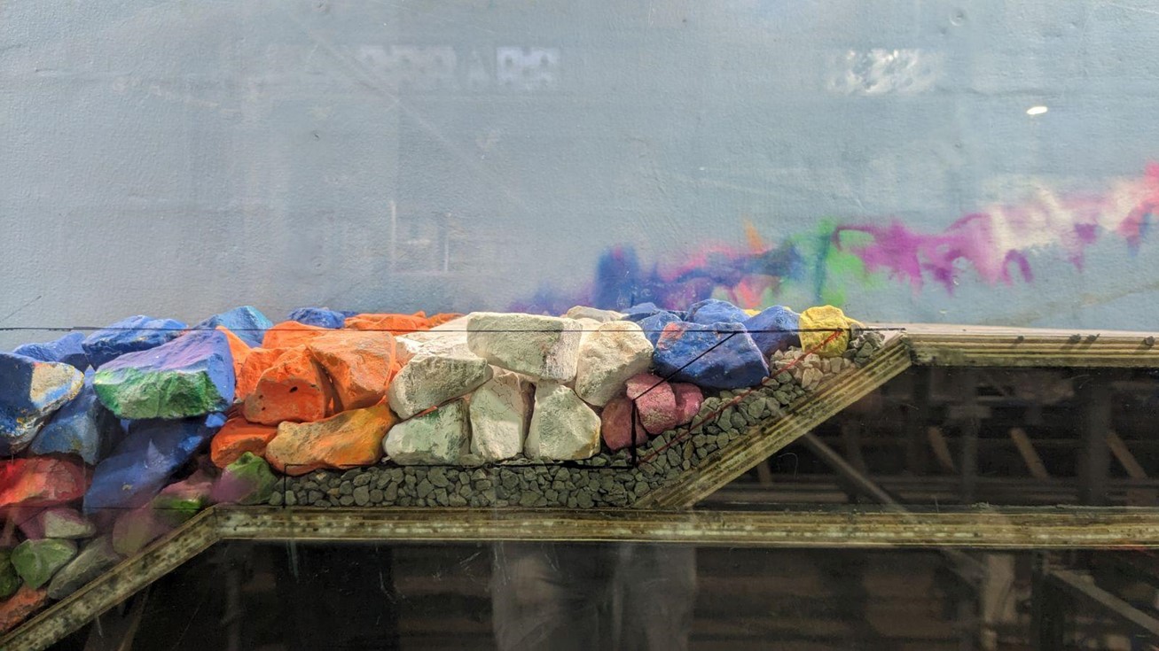
Figure 3: Rear Crest Protection Structure Physical Model
Townsville is located within an active cyclone region, requiring the design of the land reclamation area to withstand significant tides and waves generated during extreme weather events.
As part of the design process, SMEC’s team of coastal engineering specialists adopted a holistic and risk-based approach with the aid of numerical and physical modelling, to support a design which meets contemporary guidelines and standards.
The numerical and physical modelling allowed coastal processes to be simulated, with cyclonic wind field forcing and the propagation of swell through the reef to be modelled in detail.
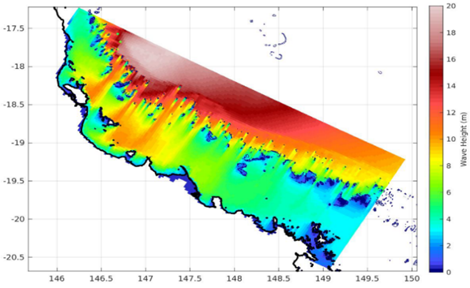
Figure 4 – WAMGBR model peak Hs wave penetration during TC Yasi (MOS Solutions SEA, 2019)
Numerical modelling was undertaken by Met Ocean Solutions Ltd and Systems Engineering Australia (SEA) Pty Ltd, simulating the impact of cyclonic winds from the Pacific Ocean and through the Great Barrier Reef. The numerical modelling confirmed the known phenomena within the Port where short wind generated waves combine with long period swell waves which travel through the submerged Great Barrier Reef structures.
Our team worked with the Water Research Laboratory at the University of New South Wales to undertake physical modelling, enabling coastal processes to be reproduced, complex wave interactions to be modelled and the performance of the rock wall bund to be assessed.
Our physical modelling approach allowed specific processes to be investigated in detail, thereby informing our bund design, as follows:
SMEC presented these findings at PIANC APAC 2024, sparking conversation across the broader industry. The Channel Upgrade works were completed in late 2024, celebrating this significant milestone with the arrival of Cunard’s luxury cruise ship, Queen Elizabeth in January 2025. SMEC is proud to have supported a significant project that will support continued economic growth of Northern Queensland.