


Stockland Aura, Environmental Services & Compliance

From the early pioneers on the Snowy Mountains Hydroelectric Scheme, to our leaders and innovators of today, our people make us who we are.
Through our network of global specialists and by collaborating with local partners, we connect you with the best teams and capabilities to deliver highly innovative and sustainable solutions.
As an organisation we are continually evaluating ways we can better provide a safe, flexible, inclusive and respectful workplace for our people and clients.
People are at the heart of our organisation, we strive to create a flexible, diverse and inclusive environment that enables our people to thrive to their fullest potential.
Explore career opportunities
Located on the southern end of the Sunshine Coast, Aura is a long-term development with sensitive habitats. SMEC’s role began with compliance and monitoring and has expanded to front-end assessments and new state approvals on key packages, adding early design input to de-risk delivery as the project interfaces with environmentally significant areas.
SMEC has provided environmental services at the 2320+ hectare development since 2012, drawing on specialist ecologists and approvals experts. The relationship with Stockland is long-standing and proactive, with SMEC acting as an independent but collaborative adviser alongside designers and superintendents.
Core routines include annual compliance reporting and targeted monitoring programs, with advice and audits aligned to the Environment Protection and Biodiversity Conservation Act 1999 and state conditions. As new works arise, SMEC assesses design intent and secures additional state approvals where required, including consolidating multiple high-risk Species Management Programs into a single site-wide approval to simplify implementation.
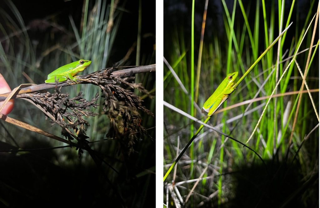
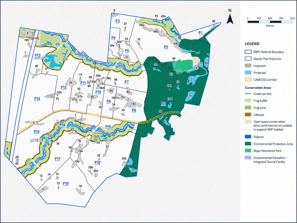
Environmental inputs shape civil works. WSUD assets and outlets are checked for separation from Wallum Sedge Frog habitat, with minimum buffers and hydrological independence applied to avoid impacts to the sensitive habitat. These criteria, developed through specialist input and long-term monitoring, guide alignments and crossing solutions for roads and drainage.
To simplify delivery, we have consolidated multiple high-risk Species Management Programs into a single, site-wide instrument, reducing ambiguity for superintendents and contractors. Contractor onboarding and regular briefings align everyone on site-specific constraints, approval conditions and why they matter. Regular sessions with Stockland plan upcoming stages and reduce risk. These routines build shared ownership of outcomes and continuity as teams change over time.
Ongoing monitoring practices feed adaptive management and improvements to habitat design and maintenance over time.
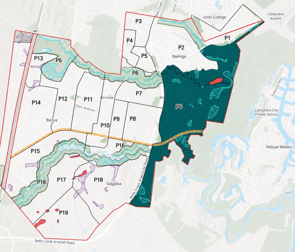
A web-based GIS portal maps the site constraints and underpins day-to-day decisions as a single source of truth. It overlays referral boundaries, protected plants mapping, the register of frog ponds and other constraints with updated aerial imagery and design layers. No work proceeds until the relevant layers are checked, constraints are understood, and pre-start sign-offs are complete. For stakeholders without GIS access, layered PDFs and geo-referenced files support field use. The same data feeds registers and annual reporting.
Aura now benefits from an extensive network of purpose-built frog ponds and protected habitat, supported by annual monitoring and compliance reporting. Year-on-year, adaptive management is growing habitat area and function, a practical model for regenerative urban development. Environmental considerations continue to inform civil delivery without slowing momentum, and site-wide approvals are being made simpler to implement for contractors and superintendents.