Expertise

From the early pioneers on the Snowy Mountains Hydroelectric Scheme, to our leaders and innovators of today, our people make us who we are.
Through our network of global specialists and by collaborating with local partners, we connect you with the best teams and capabilities to deliver highly innovative and sustainable solutions.
As an organisation we are continually evaluating ways we can better provide a safe, flexible, inclusive and respectful workplace for our people and clients.
People are at the heart of our organisation, we strive to create a flexible, diverse and inclusive environment that enables our people to thrive to their fullest potential.
Explore career opportunities
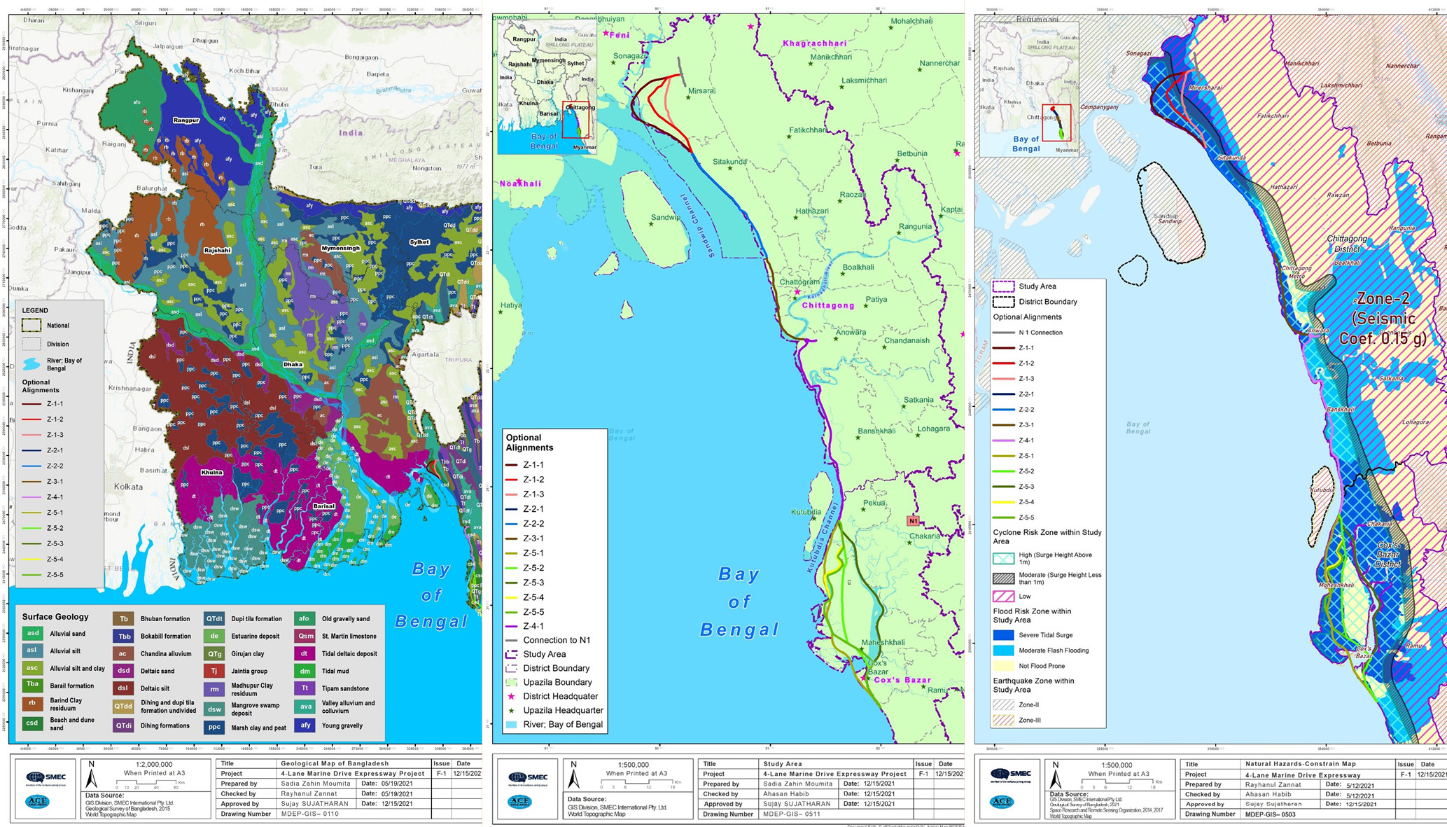
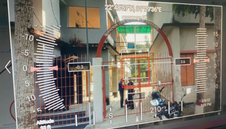
The implementation of web GIS provided access to alignment information, background information (such as administrative boundaries and transport infrastructures), and project-specific details through an intuitive platform accessible via a browser and an internet connection. This solution reduced paper usage, facilitated communication, and simplified decision-making processes.
From preliminary alignment options to environmental assessments, traffic surveys, and economic analysis, GIS has proven to be a valuable tool for reducing costs, increasing efficiency, and improving overall project management.
In developing a bespoke, web-based GIS system, Marine Drive Expressway exemplifies the transformative potential of spatial data analysis and visualization in a large-scale infrastructure development. The integration of GIS has not only optimized decision-making but has also contributed to time and cost savings while ensuring a more sustainable and environmentally conscious project implementation.
Complex highway projects require meticulous planning and consideration. At SMEC, Geographic Information Systems (GIS) technology has emerged as a powerful tool, adding value for our clients and partners across all stages of the project lifecycle as well as ongoing asset management.
My Grandfather was a chief engineer for the Snowy Hydro Scheme (which was constructed between 1949 to 1974). My Grandmother was a coal miner’s daughter. So, I guess you can say that digging rocks is in my blood.
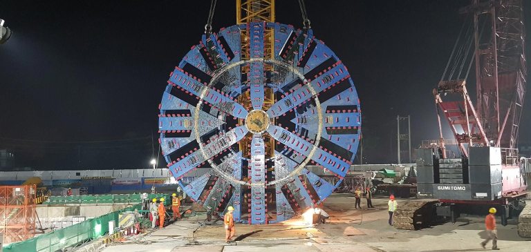
Bangladesh is a country of rivers. The Karnaphuli River services the city of Chattogram (formerly called Chittagong), the largest sea port of Bangladesh. With the rapid development of southeast Bangladesh, especially in the regions south of Chattogram, the two existing bridges over the Karnaphuli River are inadequate to accommodate the increase in traffic. With a population of over six million, the heavily congested city of Chattogram is closely surrounded on the east by the Chittagong Hill Tracts and the west by the Bay of Bengal, making an additional bridge type crossing of the Karnaphuli River unviable.
Health and safety should be an integral part of businesses, of all shapes, and sizes. At SMEC it is imperative that we protect the well-being of people associated with our company, whether on-site or in the office.