Expertise

From the early pioneers on the Snowy Mountains Hydroelectric Scheme, to our leaders and innovators of today, our people make us who we are.
Through our network of global specialists and by collaborating with local partners, we connect you with the best teams and capabilities to deliver highly innovative and sustainable solutions.
As an organisation we are continually evaluating ways we can better provide a safe, flexible, inclusive and respectful workplace for our people and clients.
People are at the heart of our organisation, we strive to create a flexible, diverse and inclusive environment that enables our people to thrive to their fullest potential.
Explore career opportunities
Georgia is located south of the Caucasus Mountain range, with Russia to the north, Armenia and Turkey to the south, Azerbaijan to the east, and the Black Sea to the west. It has a population of 3.7 million. Georgia, due to its geographic location, provides the shortest transit link between Central Asia and Europe. Hence, transport plays a pivotal role in supporting the national economy, and development of the transport sector is vital to increasing economy of the region through reduced transport costs and increased transit revenues.
The 81 km Poti – Batumi-Sarpi Road along the western coast of the country, mostly located in the Adjara Autonomous Republic, is a key highway and international transit route in Georgia. It is connected to the major Black Sea ports of Georgia, via Batumi and Poti, and several beach resorts including Batumi and Kobuleti. The existing main road connecting Sarpi at the border with Turkey to Poti, is a key transit route along the coastline of the Black Sea for heavy goods and passenger traffic from Turkey to Tbilisi and then onto Azerbaijan and the Caspian Sea.

In recent times, there has been a marked increase in the number of accidents on the road due to increased traffic and heavy congestion, particularly at Batumi and Kobuleti during the tourist season. As transit traffic from Turkey keeps growing, the congestion cost in Batumi city become critical. In addition to safety, the heavy transit traffic also poses social and environmental problems. Hence there was an urgent need to reroute transit traffic outside of the Batumi city.
One of the other priorities for Georgia is to improve its competitiveness as a transit country by rehabilitating the East-West Transport Corridor. The east-west highway between Azerbaijan and Georgia is already a major route for oil exports from Azerbaijan: Central Asian countries, relies on the ports of Poti and Batumi on the Black Sea as the exit points.The government was aware that the potential of the transit corridor was not being realised, and therefore decided to modernize the ‘red bridge border checkpoint’ in Sarpi.
The new bypass road skirting the busy port city of Batumi will cut traffic congestion and support smoother transport movements along a key east-west highway near the city. Additionally, a controlled-access highway will have 4 grade separated interchanges to regulate traffic ingress/egress. Outcomes of the project include:
SMEC was appointed in 2017 as Technical Advisor to provide consultancy services for Design Review (and suggested redesign where required prior to commencement of construction) and construction supervision. The design review period was for 3 months. Construction commenced on 14 March 2018.
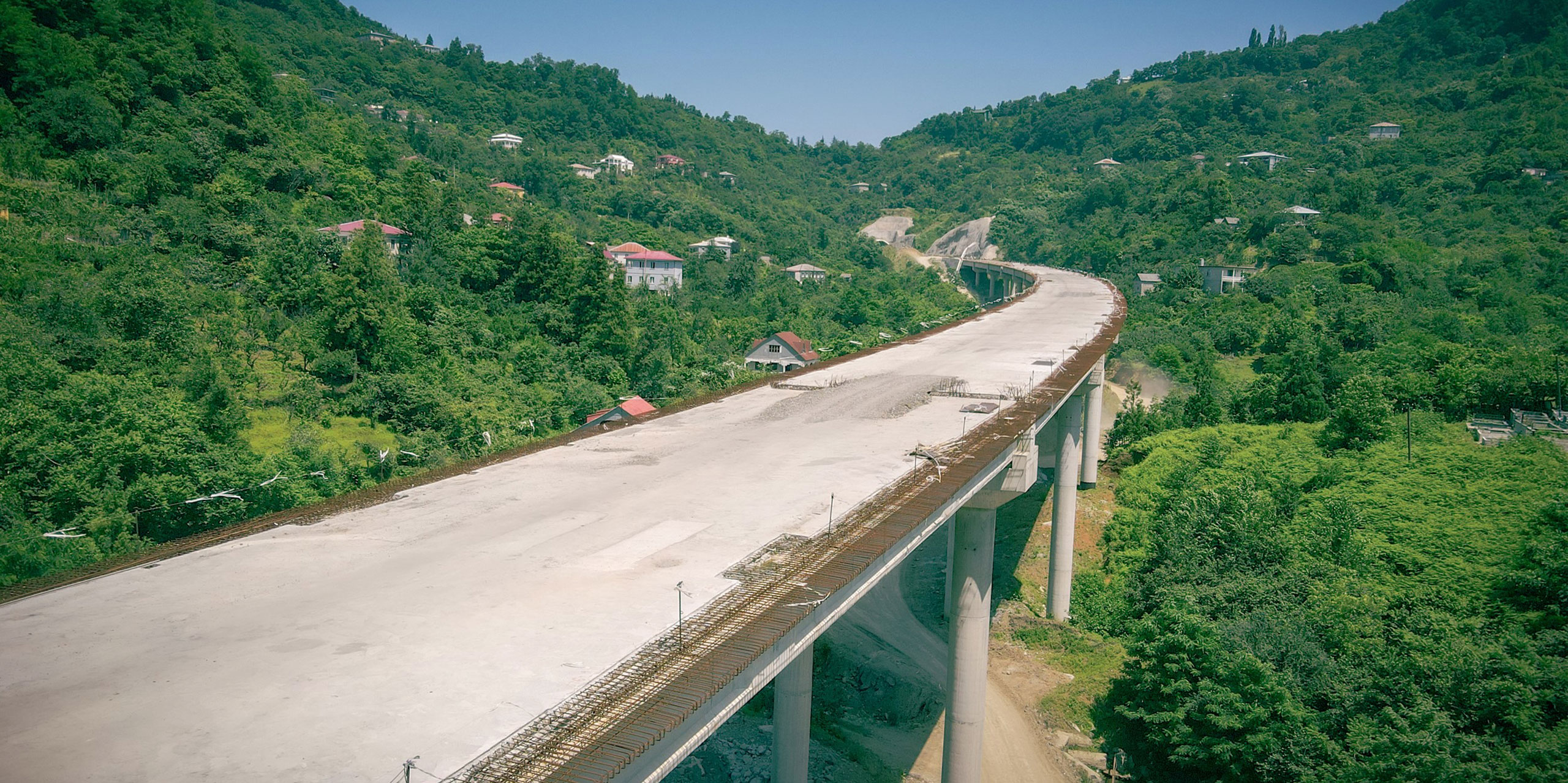
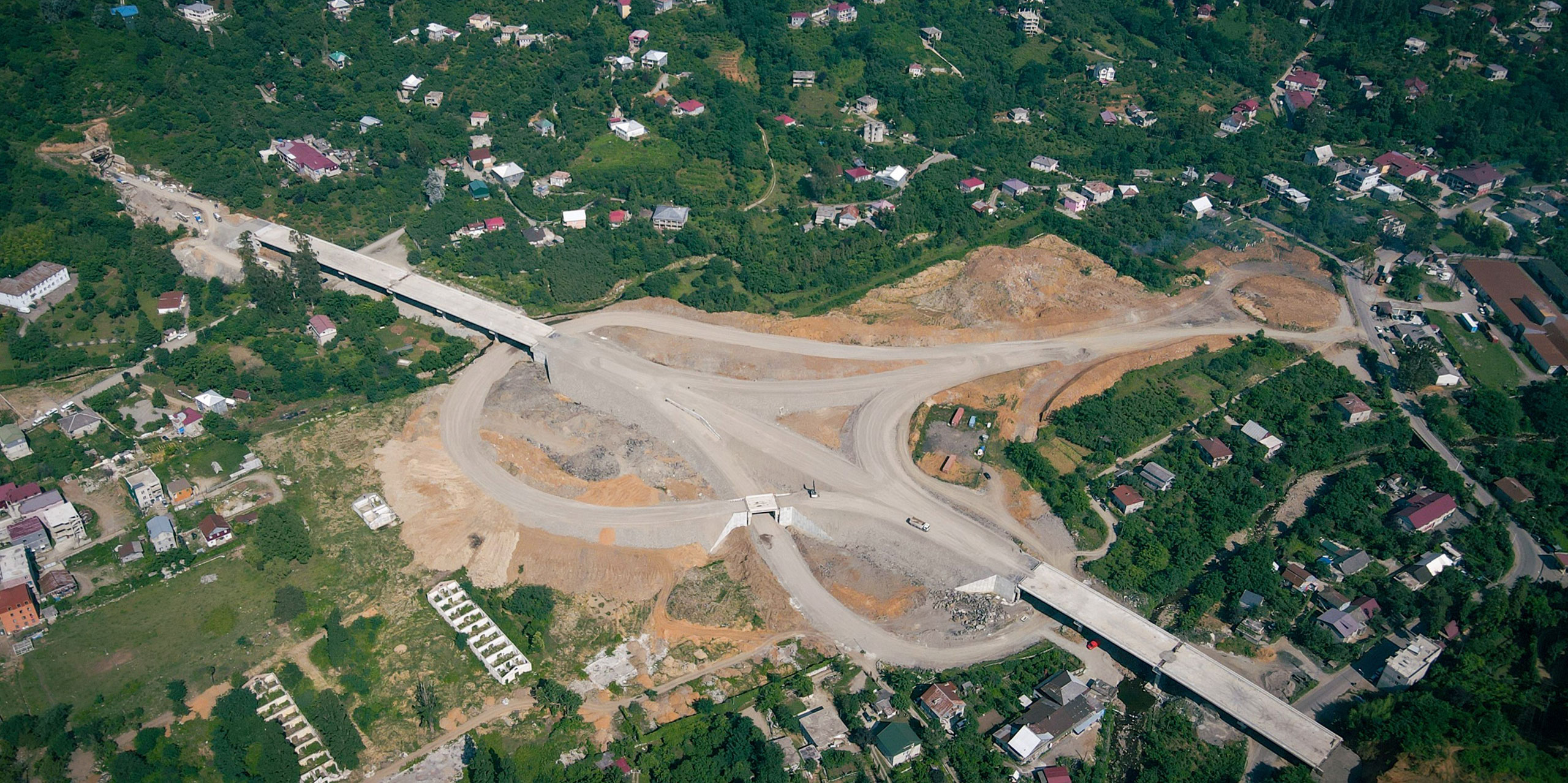
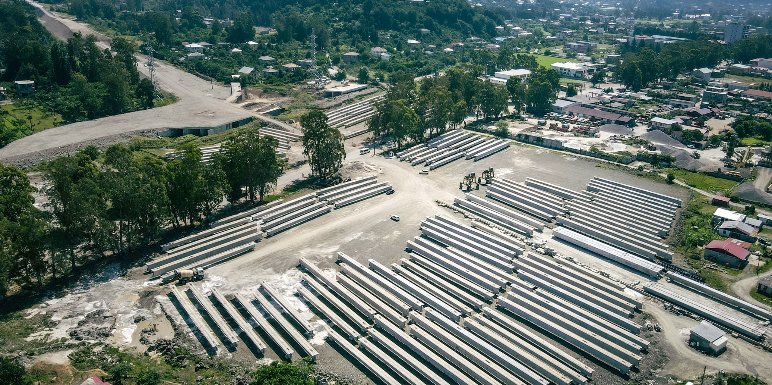
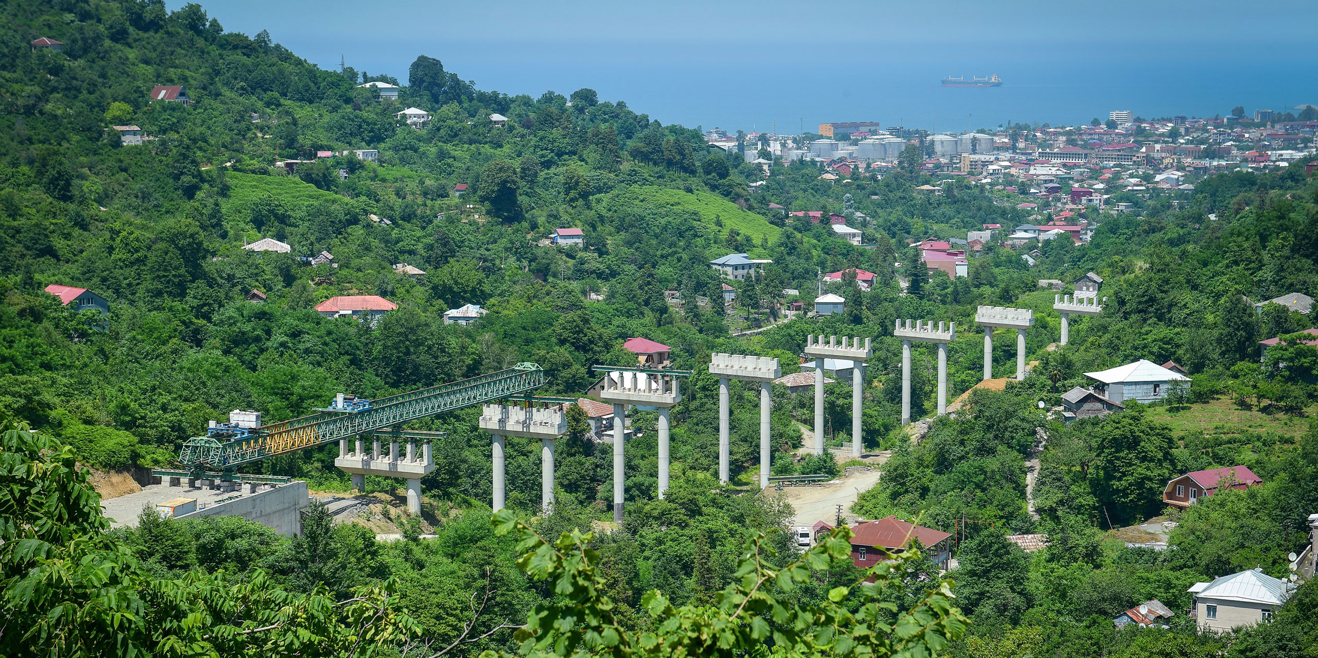
The total length of Batumi Bypass Road is 14.3 km while the width is 14m. The section flows through mountainous terrain and considers construction of five tunnels, nine bridges, seven viaducts, nine overpasses, fifty-seven culverts and four interchanges. The project will also support repairs and maintenance work on about 200 km of secondary connecting roads.
Classification of Road: International Highway
As the Technical Supervisor, SMEC has played a key role on the project, with a project team of up to 40 specialists, including experienced local staff along with international experts who hold important technical positions on the project. Leveraging our global expertise, our teams ensure that the many structures of this complex project are delivered in alignment with international standards.
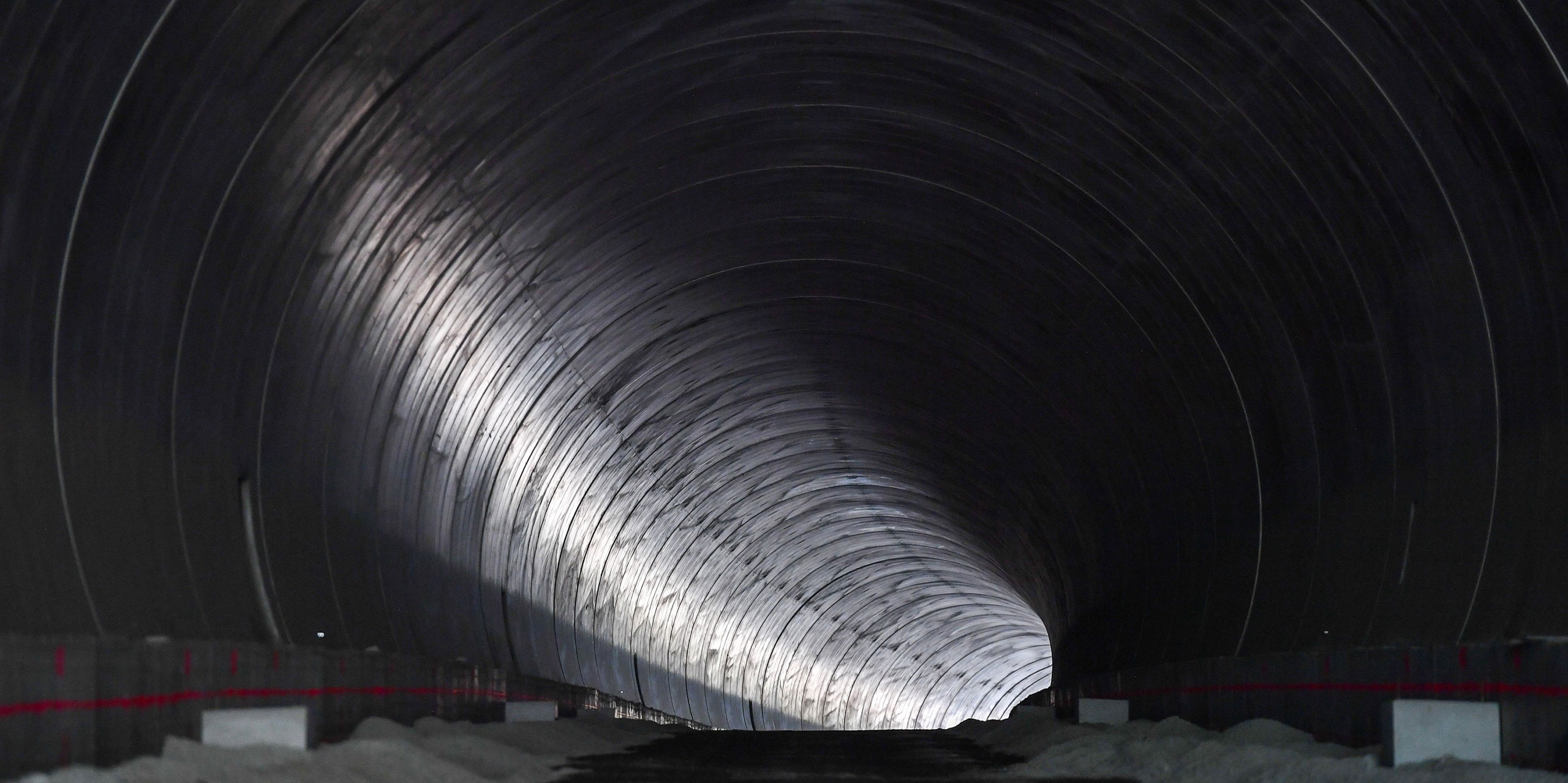
There are five tunnels associated with the project, the longest Longest Tunnel is 1067m including cut and cover sections. Each tunnel is reinforced concrete, lined with a finished internal diameter of 11.65m to accommodate two lanes of highway for bidirectional traffic. Varied ground conditions have challenged the tunnelling operations and the use of conventional tunnelling practices.
For the Tunnels, there were weak soils and high cut areas at the portal, additionally the territory adjacent to the portals were densely populated. Through the application of industry-recognized techniques, sound engineering judgement and close supervision SMEC’s team was able to effectively overcome these challenges.
The initial design proposed protecting the high cut areas with terra mesh walls but this overlooked the fact that this would require additional land acquisitions, which would result in additional cost and subsequent delay. SMEC proposed a solution to replace the terra mesh walls with pile walls and to secure the portal area with steel struts. As a result, the acquisition of additional land needed for protection of the slopes during the excavation phase was avoided.
The proposed scaffold system proposed for the cast in situ high bridges were also replaced to make the construction process safer, considering the slope areas adjacent and the height of the bridges. Instead a launching girder machine was used and cast in situ bridges were replaced by pre-stressed beams.
SMEC worked as a supervisor along with the Contractor JV Polatyol and Mapa. SMEC deployed a multidisciplinary team of experts to optimise environmental, economic and social outcomes. Stakeholder consultation & regulatory engagement was crucial to ensure the scheme incorporated local perspective.
The governments strategic ambitions have been supported by development partners (World Bank, European Investment Bank, Japan International Cooperation Agency, and ADB, AIIB) who have jointly extended their assistance to rehabilitate and upgrade the road networks, the backbone of regional connectivity.
Every stage of the project has been completed in a speedy and quality focused manner, aided by participation from the client, consultants, and community, with regular inputs from key stakeholders. This led to data and knowledge transfer between various stakeholders and the client, and vice versa for effective implementation: cite information, progress reports, contract documentation and correspondence in a cloud-based system.
The benefits include reduced congestion and safer passage on the existing road, and faster travel for highway traffic using the bypass. The Batumi Bypass Road has generated employment during its construction phase and, in the long-term, by increasing tourism opportunities in Batumi. The detailed design estimates that 55% of traffic on the existing road is expected to divert to the bypass road (as per Environmental Impact Assessment of BBRP).
The economic analysis employs the standard cost-benefit analysis of road projects, where the cost of the road project is measured against benefits such as reduction in vehicle operating cost (VOC), reduction in travel time cost and accident rates. The economic analysis covered 2016–2041, with the first full year of operation in 2022. The analysis is based on a comparison of the with- and without-project scenarios and used economic prices in the first quarter of 2016.
The baseline traffic data was developed using Research and Development’s Annual Average Daily Traffic (AADT) counts, and origin/destination (O/D) surveys conducted during the project feasibility study. Seasonal adjustment factors were used to calculate the AADT. The 2015 AADT of 18,244 vehicles has an average composition of: 65% cars; 27% buses and passenger vehicles; and 8% light and heavy cargo vehicles and trucks. The existing traffic has led to serious traffic congestion with average vehicle speed of only 30 km per hour.
The forecast of future traffic on the bypass road is based on 3 components:
For normal growth, traffic demand elasticities (relative to GDP) of 1.2 for passenger and 1.1 for freight were used for the first 10 years; these were gradually reduced to 1.05 and 1.0, respectively, during 2041–2049. With these components, a summary of the traffic forecast is outlined below:
Table Projected Traffic in Selected Years (number of vehicles per day)

The savings in travel time cost constitute a major part of the project benefits. Traffic diverting to the Batumi Bypass Road Road will benefit from higher speeds on a smoother riding surface. Traffic that continues to use the existing road will also benefit from a reduction in the volume of traffic and reduced congestion. It is estimated that there would be time savings of more than 60% for most types of vehicles. Savings in vehicle operating cost (VOC) per km, and a reduction in traffic accidents by nearly half are also expected. The savings in VOC per km were projected to be 8.5% for cars, 17.3% for light goods vehicles and 23.8% for heavy goods vehicles.
With the above traffic projection, costs and benefits, an economic evaluation over the 25-year life cycle of the projects was undertaken. A residual value of 30% of capital costs was included in the final year of the evaluation period.
The results show that the Batumi Bypass Road Road is economically viable, with an estimated economic internal rate of return (EIRR) of 16%, and an estimated net present value of around $62 million at an interest rate of 12%. The sensitivity of the EIRR was tested and a 10% capital cost increase combined with a 10% benefit reduction still derives an EIRR of 13.6%, indicating a well justifiable investment.
Two international roads, E60 and E70 of the European network, form Georgia’s East West Highway (EWH)-part of the Europe-Asia corridor through the Caucasus. It runs north from the Turkey border at Sarpi, serving the Black Sea ports of Batumi and Poti, then east to Tbilisi, and then southeast to the border with Azerbaijan, a total distance of 412 km. It will constitute the Central Asia Regional Economic Cooperation (CAREC) road corridor after Georgia joined the CAREC program in 2016. The EWH carries over 60% of the total foreign trade and is seen as a central piece in the government’s strategy of playing the role of a transport and logistics hub in the region.

The Socio-economic Development Strategy of Georgia emphasises environmental sustainability and integrating Georgia within regional and international transport systems. Construction of the Batumi Bypass Road has been a very crucial step in the economical and infrastructural growth for Georgia. The Batumi Bypass Road Road is intended to be completed by December 2022 and encourages inclusive economic growth by enhancing regional integration.

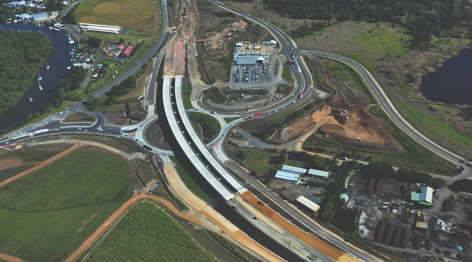
Delivered six-months ahead of schedule, the Albion Park Rail Bypass will significantly reduce congestion and improve travel times on the M1 Princes Motorway.
SMEC’s Dr Richard Kelly, Chief Technical Principal – Geotechnical Engineering, has contributed to industry-leading research and innovation in the field of soft soil engineering.