


Molonglo 3 East

From the early pioneers on the Snowy Mountains Hydroelectric Scheme, to our leaders and innovators of today, our people make us who we are.
Through our network of global specialists and by collaborating with local partners, we connect you with the best teams and capabilities to deliver highly innovative and sustainable solutions.
As an organisation we are continually evaluating ways we can better provide a safe, flexible, inclusive and respectful workplace for our people and clients.
People are at the heart of our organisation, we strive to create a flexible, diverse and inclusive environment that enables our people to thrive to their fullest potential.
Explore career opportunities
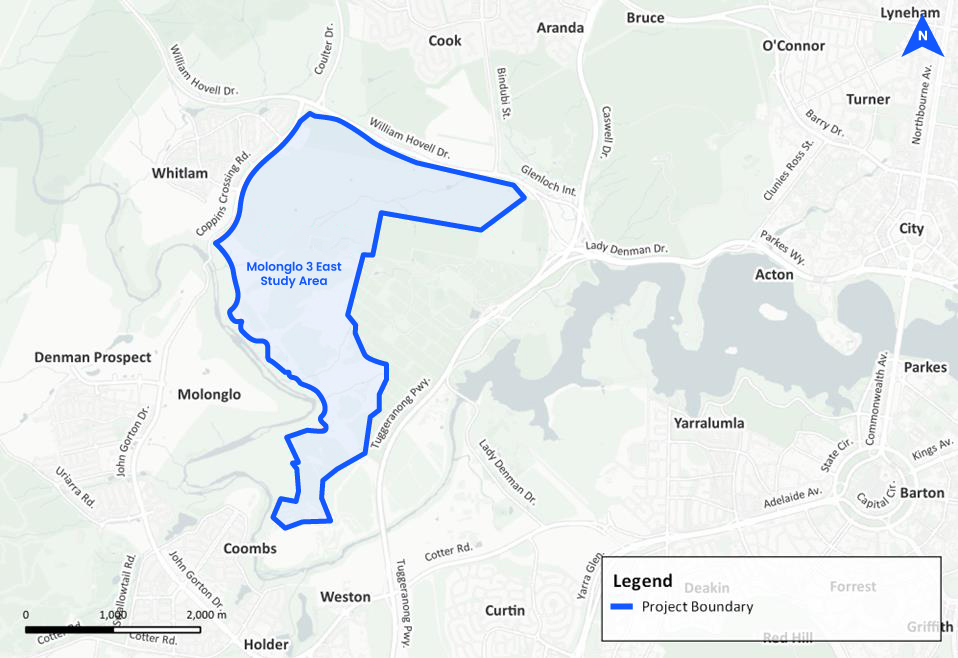
The ACT Government’s Planning Strategy 2018 and Territory Plan 2023 identified M3E as a key expansion area. Located in Canberra’s Molonglo Valley district, M3E will contain the final three future suburbs in the district and accommodate approximately 30,000 residents. The district is projected to grow to 70,000 people by 2050.
Appointed under the Preliminary Roads and Earthworks Design and Urban Water Strategy and Concept Plans contract, SMEC worked closely with the Environment, Planning and Sustainable Development Directorate (EPSDD) and key stakeholders to develop an integrated framework for roads, transport, and water-sensitive urban design (WSUD).
SMEC’s multi-disciplinary approach addressed the core challenges of planning a liveable and sustainable precinct, ensuring a logical and well-integrated urban structure.
Land use, environment and mobility:
As part of the scope, SMEC delivered planning advice, preliminary road and earthworks design, strategic water infrastructure and WSUD planning, transport and active travel network planning, and geotechnical and environmental assessments.
Water management was a key opportunity for innovation. Shifting away from traditional large-scale detention basins to a distributed stormwater management system, reducing costs while improving water quality, ecological resilience, and urban cooling.
The transport network was carefully structured to support multi-modal movement, ensuring prioritised active travel routes, integrated public transport corridors, and infrastructure ready for light rail expansion. Walkable neighbourhoods and well-connected movement corridors were fundamental to improving mobility and reducing car dependency.
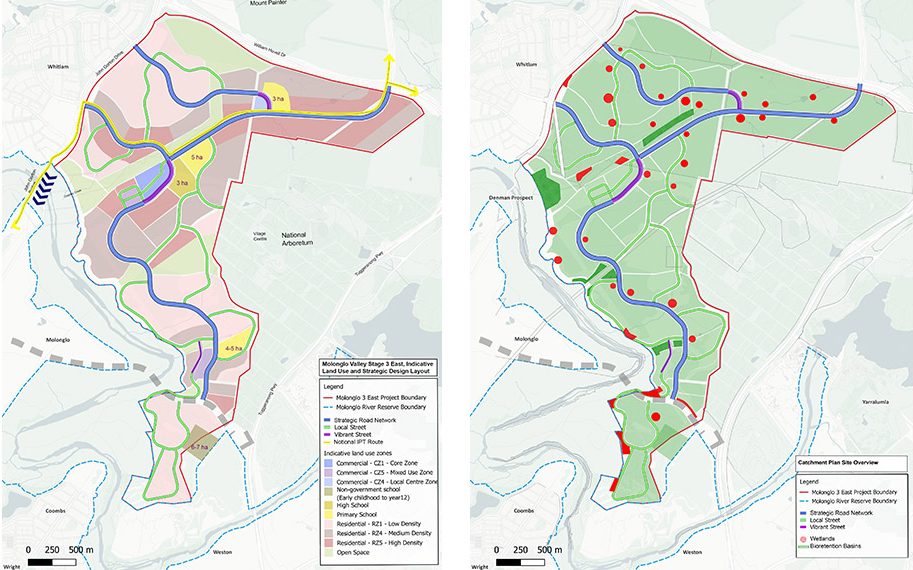
Digital engineering played a pivotal role in optimising the planning outcomes. SMEC applied GIS mapping, digital terrain modelling, and 3D analysis to optimise earthworks and reduce cut-and-fill volumes, achieving significant cost efficiencies. These tools also enabled evidence-based planning decisions, ensuring that land use allocations were informed by topographical, environmental, and infrastructure constraints.
Molonglo 3 East is set to redefine best practice for integrated land use and infrastructure planning, delivering a climate-adaptive, liveable community that supports Canberra’s long-term urban growth strategy. By aligning land use, transport, and environmental planning, the project ensures a balanced and resilient urban framework that meets future community needs.
The innovative distributed WSUD system, combined with strategic transport planning, ensures that M3E is climate-responsive and cost-efficient. By applying best-practice digital engineering, SMEC optimised development footprints, safeguarded ecological corridors, and ensured seamless integration with existing suburbs. This collaborative effort sets a new benchmark for sustainable and infrastructure-led urban planning in the ACT.
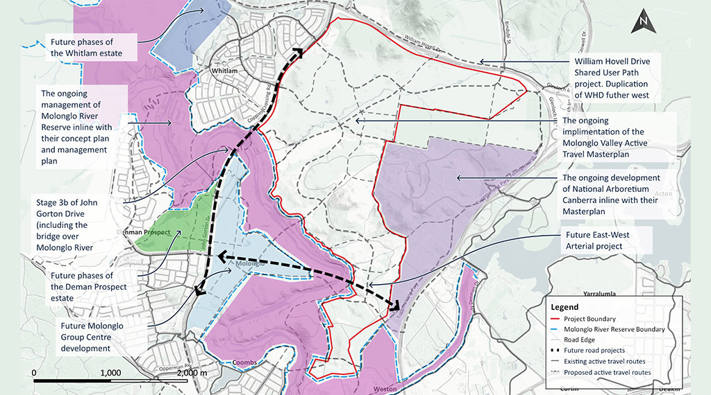
This study and the information provided are preliminary and high-level, with further work underway by the SLA on the future planning and design of the M3E area, starting with the newly announced suburbs of Bandler and Sulman (Jan 2025).